Teachers
A lesson for your classroom or geography club
Tropical cyclone
All teacher notes · Open the lab
A suggested lesson sequence
Use these stages at your own pace. Pause for students to sketch, compare observations or lead part of the demonstration.
01
Observe
Locate eye, eyewall and rainbands. Trace inflow, ascent and outflow, distinguishing subsidence in the eye.
02
Tinker
Read the wind profile and its 30 km maximum. Change Intensity; explain why the pressure is model-dependent.
03
Explain
How are the strongest winds near the eyewall related to the pressure change towards the centre?
04
Check
Choose an answer and explain your reasoning. Each question includes feedback.
Rehearse with the model
The same scene and controls as the lab. Load it when you are ready; use Start projector for the full classroom view.
Before the lesson
Identify the eye, eyewall and rainbands of a tropical cyclone and explain how warm ocean water supports its circulation.
Open the model before the lesson and choose a view that makes the important feature easy to see. Drag to rotate, and use the on-screen controls to change one variable at a time. The Controls panel explains the available keyboard shortcuts.
Pause the animation at a useful moment. Ask students what should happen next, then play it to test their explanation.
Guide the demonstration
Locate eye, eyewall and rainbands. Trace inflow, ascent and outflow, distinguishing subsidence in the eye.
Read the wind profile and its 30 km maximum. Change Intensity; explain why the pressure is model-dependent.
Discuss a common misconception
“The calm eye means a tropical cyclone has passed and the danger is over.” The eye is surrounded by the eyewall, where winds and convection are strong. If the eye crosses a location, the opposite eyewall may arrive after a temporary lull, with a changed wind direction. Rainfall, flooding and coastal water levels can also remain hazardous beyond the strongest winds.
Build the explanation
A tropical cyclone draws moist air inward near the surface, with strong ascent in the eyewall and outflow aloft. Its eye has weaker winds and often descending air, distinct from a tornado funnel.
Read the wind profile and its 30 km maximum. Change Intensity; explain why the pressure is model-dependent.
The ideal vortex links wind and pressure through stated assumptions; it does not calculate storm development, rainfall or a track.
Teaching notes
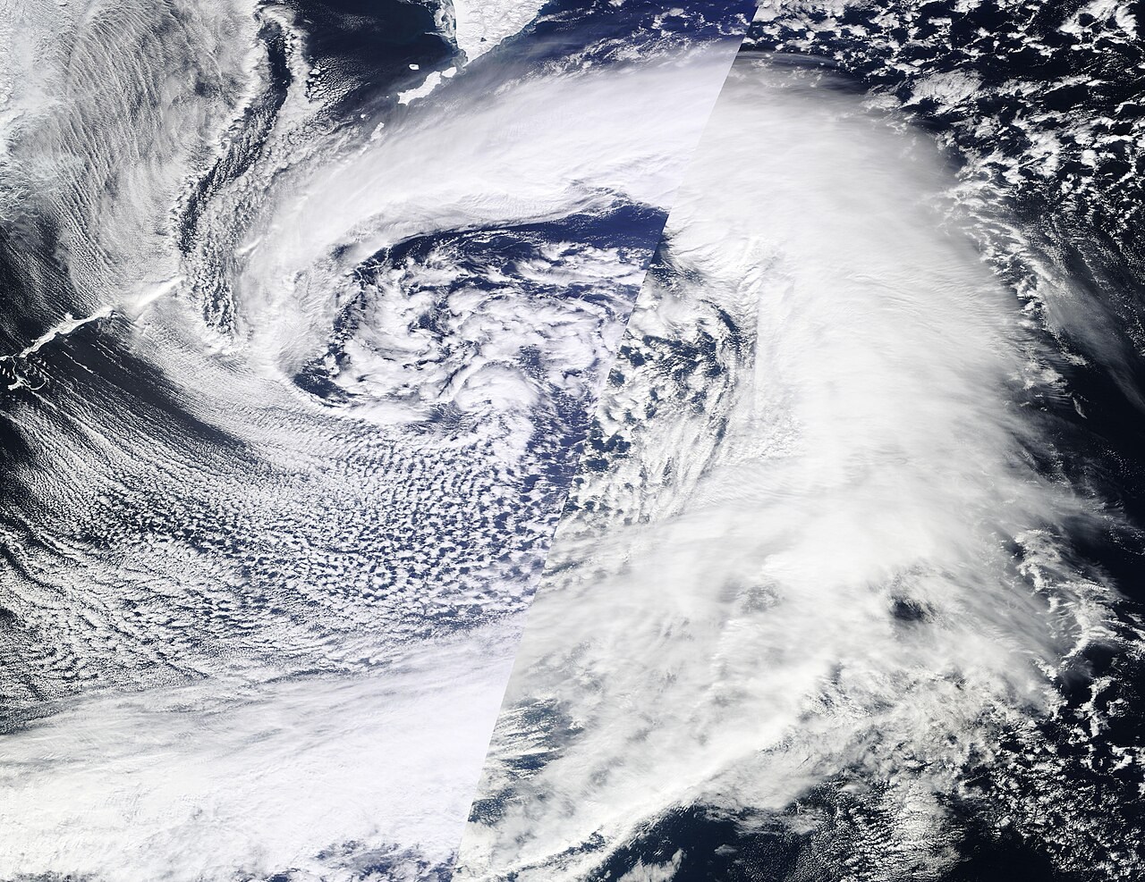
Distinguish a tropical cyclone from a midlatitude windstorm and apply intensity scales only to the storms they describe.
Locate the strongest winds around the eyewall rather than in the relatively calm eye.
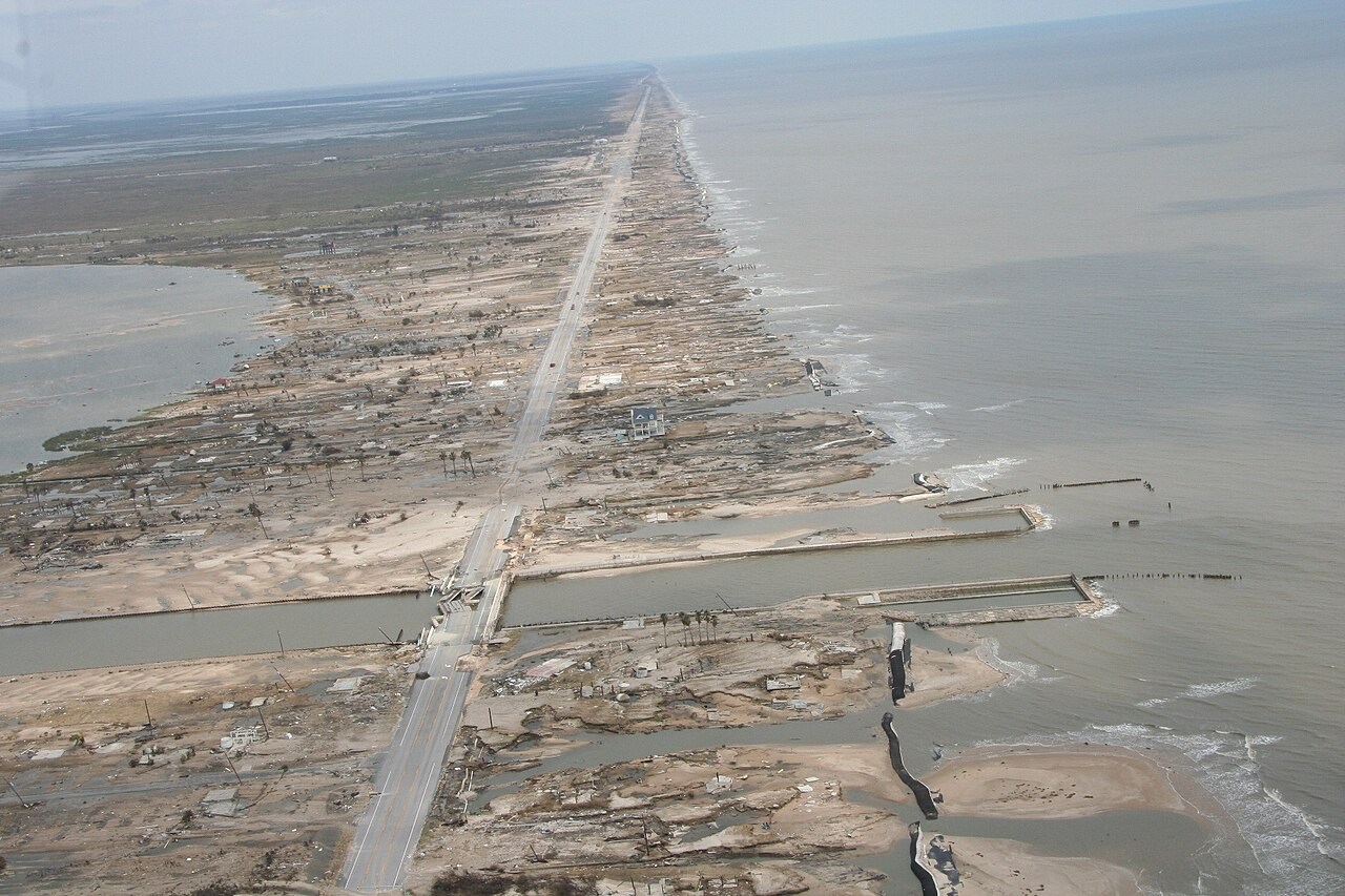
Explain storm surge as a rise in sea level driven by the storm, separate from both tsunami waves and ordinary wind waves.
Check understanding
Open Check for 4 questions. Ask students to explain their choice before revealing the answer.
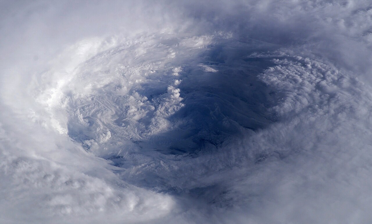
Return to the opening photograph. Ask students to identify one visible feature and explain which part of the model helps account for it.
Look more closely
Use these observations to connect the vocabulary to features students can identify.
Storm surge
Midlatitude cyclone
Sources to keep beside the lesson
- NOAA NHC
- Met Office
- NOAA tropical cyclone structure
- Met Office tropical cyclone facts